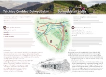
Distance: 10.5km/6.5miles, allow 3.5-4hrs
Grade: Moderate with one steep climb
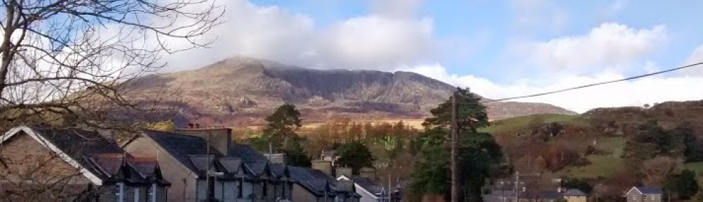
Summary: Scenic riverside and lake with wide views
The Route
1. Follow walk 2 to Tan-aeldroch farm (point 2). Continue past the farm along the drive and turn right over a stile immediately before the bridge and walk through a riverside campsite. Go over a stile into woodland. At path fork, ignore path left and continue ahead to the railway viaduct (Pont Gethin). Go under the arch and bear left following path alongside the fence to a stone house. Turn left onto track and left again through an old gateway. Follow the path to a wooden footbridge and cross the river.
2. Continue to the A470 and cross carefully. Turn left along the road, passing under Pont Gethin and then immediately turn right onto a track, signed Craig Lledr. After approx 60m turn left onto a narrow signed path, rising diagonally to a footbridge over a stream. Continue on path climbing more steeply up the hillside, recrossing the stream and ignoring minor paths on either side. Cross a forest road and continue ahead on the clear footpath. Turn right at a path T-junction near ruins on the left, and continue gradually climbing.Walk alongside a stone wall on the right then continue on the clear path climbing to a forest road. Turn right and follow the forest road above Llyn Elsi. Where the track turns away from the lake, take the path ahead along the lakeside leading to the monument overlooking the lake.
3. From the monument take care to follow the path directly opposite the one you arrived on (there are several paths), crossing open ground for a short distance then entering woodland. Cross a forest road and continue ahead on the footpath, descending steeply. Cross a second forest road half-way down the hillside and continue zig-zagging downhill. Cross a footbridge to join a track and follow this down to join the road behind the church in Betws-y-coed.Walk down to the main road and turn right, then left at next junction to the station. (To return via Sarn Helen turn left along the main road and right over the bridge, following route 3b in reverse.)
Walking Advice
Brief route directions are given but it is essential that you also take an OS 1:25000 Explorer map, as few routes are fully waymarked. Routes that cross the moorland need particular care and good map-reading skills.
Please follow the country code and make sure you keep dogs under control, particularly near livestock.
Rough distances are given in the routes directions. As a guide allow 15 kilometers per kilometer walking at an easy pace on the flat but allow an extra ascent(roughly 1 minute per 10m of ascent). Overall timings for the walk are s are generous, allowing time for stops.
Equipment
Walks require walking shoes and warterproof clothing and always take food and water. Some routes through the forest and moor can be very boggy.
Please be aware that this booklet was made in early 2008 and many of the routes are in a working forest and paths may inevitably change. If you know of any changes that have taken place to these routes or would like to add any extra information regarding these routes please contact mentersiabod@directsave.net
Copies of the booklet are available to purchase from the Community Pavilion and Siop y Llan Dolwyddelan, The Eagles Penmachno, Shell Garage and Tourist Information Centre Betws-y-Coed. Please note that all funds raised are put back into footpath maintenance in Penmachno and Dolwyddelan. For more information contact mentersiabod@directsave.net
This post is also available in: Welsh