- Distance:
- 8km / 5miles, allow 2.5 -3hrs
- Grade:
- Moderate with some steep climbs
- Limited parking at the start:
- Pull-in off forest track, grid ref: SH807531 (Alternative parking at Conwy Falls cafe, at junction of A5 and B4406)
- Summary:
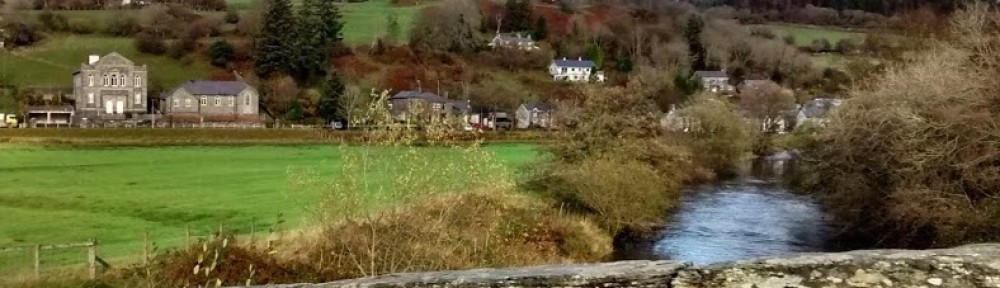
- Forest and falls with wide views
The Route
1. Return to the road and turn right back towards the river. (Notice the medieval pack-horse bridge, known as Roman Bridge, alongside the road bridge). Just before the bridge turn right onto a signed footpath, climbing uphill. Where the path forks keep left, walking with the river on the left. Cross a stile and continue ahead. Where a fence bars the way cross a stile on the right onto a forest track. Turn left and walk along the track for approximately 1.5km. Pass a track on the left down to the farm buildings of Benar (dating from 16th century) then take a narrow footpath on right (yellow arrow) when the buildings are directly below.
2. Follow the natural path uphill, crossing a stream, and continue to a forest track. Turn left and follow the track as it swings right then steadily climbs. Ignore paths joining on either side and continue uphill on main track. (NB Beware of cyclists as a bike trail joins the track for a short section). Just after passing a clearing on the right where gravel is being removed, the track bears left downhill, with good views across the Lledr Valley to Snowdonia on the right. Continue on this track, ignoring footpath and bike trail that cross the route.
3. Where the main track forks, just beyond a metal barrier (usually open), turn right off the track onto a narrow natural path, descending the hillside. Continue on this path down to the road. This path was once the main route to Fedw Deg, home of medieval knight Gruffydd ap Dafydd Goch whose stone effigy in full armour lies in St Michael’s church, Betws-y-coed. His body was reputedly carried down this track for burial!
4. Continue on this path down to the road. Turn right and follow the road above the river past the Machno Falls (detour along signed path to view the falls) for about 1.5km back to the start.

Walking Advice
Brief route directions are given but it is essential that you also take an OS 1:25000 Explorer map, as few routes are fully waymarked. Routes that cross the moorland need particular care and good map-reading skills.
Please follow the country code and make sure you keep dogs under control, particularly near livestock.
Rough distances are given in the routes directions. As a guide allow 15 kilometers per kilometer walking at an easy pace on the flat but allow an extra ascent(roughly 1 minute per 10m of ascent). Overall timings for the walk are s are generous, allowing time for stops.
Equipment
Walks require walking shoes and warterproof clothing and always take food and water. Some routes through the forest and moor can be very boggy.
Please be aware that this booklet was made in early 2008 and many of the routes are in a working forest and paths may inevitably change. If you know of any changes that have taken place to these routes or would like to add any extra information regarding these routes please contact mentersiabod@directsave.net
Copies of the booklet are available to purchase from the Community Pavilion and Siop y Llan Dolwyddelan, The Eagles Penmachno, Shell Garage and Tourist Information Centre Betws-y-Coed. Please note that all funds raised are put back into footpath maintenance in Penmachno and Dolwyddelan. For more information contact mentersiabod@directsave.net
This post is also available in: Welsh